
ForTy 2020: Global map tells old-growth forest from plantations and farms at 10 meters
Google DeepMind and Google Research, together with WRI and IIASA, have released a global map that assigns every 10×10-meter patch of land to one of six forest and land-use types. An early time series from 2017 to 2025 shows what replaced forest after it was lost. The data is freely available in Google Earth Engine.
What it's about
Google DeepMind and Google Research, together with the World Resources Institute (WRI) and the International Institute for Applied Systems Analysis (IIASA), have released the Forest Typology (ForTy) 2020 map. It sorts every 10×10-meter patch of land on Earth into six categories. It comes with an early time series for 2017 to 2025 that shows, year by year, how forest types have changed, including where natural forest was replaced by plantations or farms. Both are freely accessible in Google Earth Engine, a platform for satellite data and geospatial analysis.
Why "tree cover" isn't enough
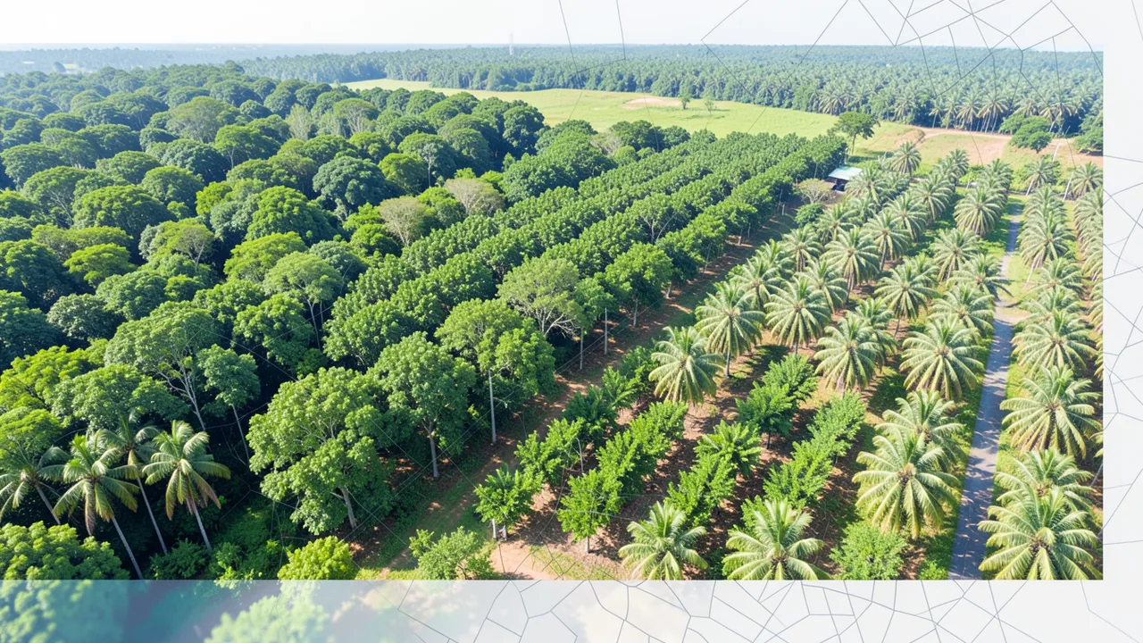
From space, an old-growth rainforest, a eucalyptus plantation and an oil palm farm can look equally green. But they store very different amounts of carbon and support very different numbers of species. According to Google, a primary forest that has never been cleared holds far more carbon and biodiversity than a single-species plantation harvested every one to two decades.
Most global maps only show whether trees are present. That's a problem for the EU Regulation on Deforestation-free Products (EUDR). Under it, coffee, cocoa or palm oil can't come from land that was forest in 2020 and has since been converted to agriculture. Wood products such as furniture must also be free of forest degradation. They can't come from land where primary forest or naturally regenerating forest has since been converted to plantation or planted forest. Companies and authorities therefore need to know what kind of forest they're dealing with and what follows a harvest.
The predecessor was last year's "Natural Forests of the World 2020" map. It only separated natural forest from all other tree cover. ForTy goes further and tells forest types apart in more detail.
The six categories
The classification follows definitions from the UN Food and Agriculture Organization (FAO):
- Primary forest: native forest with no visible human disturbance.
- Naturally regenerating forest: forest that came back on its own, for example after logging or fire.
- Planted forest: forest planted or seeded by people and managed over long cycles.
- Plantation forest: fast-growing, intensively managed tree farms, often of a single species.
- Tree crops and agroforestry: farms for products other than timber, such as oil palm, rubber, cocoa or fruit.
- Other land: everything else, from grassland and cropland to cities and water.
How the model works
Training was difficult because the categories partly depend on how the land is used, not just how it looks. To handle that, the team built a large collection of about 1.7 million labeled locations. They come from expert surveys, national and regional datasets, and targeted follow-up checks where the model struggled.
The model uses an architecture designed specifically for remote sensing data. Its main input is embeddings from AlphaEarth Foundations. These are compact summaries of years of satellite observations for each 10-meter pixel. They let the model pick up subtle cues such as planting patterns, growth cycles and harvest rhythms.
Accuracy and probabilities
With IIASA and WRI, ForTy was validated at more than 9,000 randomly chosen locations worldwide. At each site, two trained experts reviewed high-resolution imagery and years of satellite data. According to Google, ForTy picked the correct forest type 90% of the time and separated forest from non-forest 95% of the time. Google says it outperforms other global forest maps. These are vendor claims, and the text gives no detailed comparison.
ForTy also provides a probability value for each class instead of a yes/no label. Users can adjust thresholds to fit their purpose. A company checking EUDR risk can accept only pixels where the model is very confident. A researcher estimating total forest area can use the full range of probabilities.
The time series: hidden changes
The early time series applies a similar approach to every year from 2017 to 2025. It shows where forest is disappearing and regrowing, and also what kind of change is happening. Examples include natural forest turning into a timber plantation, or fallow land reverting to forest.
That matters because some changes are hard to see from space. If natural forest is cleared and replanted as a plantation, the land soon looks green again. Ordinary tree cover maps may miss that. According to Google, ForTy makes such losses and gains visible, globally, every year and at 10-meter resolution.
Availability and outlook
The map is described in the journal Scientific Data. The map and time series are freely available under an open license in Google Earth Engine. In the coming months, Google plans to keep improving the time series with partners and users. ForTy is part of Google's "AI for Nature" research and is new in Google Earth AI, a collection of geospatial models and datasets.
Our take
For supply chain checks under the EUDR, for conservation groups and for researchers, telling forest types apart is a practical step forward from plain tree cover maps. The time series is especially useful because it also captures natural forest being replaced by plantations. The probability values let you tune how strict you want to be for your purpose.
A few caveats: the accuracy figures come from the vendor and its partners. The time series is explicitly an early release and is meant to be improved. And the categories partly depend on land use, which can only be inferred indirectly from satellite images. For legally relevant decisions, thresholds and regional checks still matter.
Sources
- Google DeepMind deepmind.google
Ask the AI assistant
Questions about this article, installation or background? Our assistant knows this page and runs on our own machine, not in someone else's cloud.
The Assistant is an AI (Gemma 4) and can make mistakes – please check important details against the source. Questions are used only to generate an answer and are deleted after one hour. Please don't enter any personal data.



Comments
What do you think? Already tried it? Write it here, no sign-up needed.
Comments are public. Links aren't allowed, and we delete abusive posts. You can delete your own comment at any time in this browser. Learn more in the Privacy Policy.